MachineryGuide GPS app (Demo) - A Comprehensive Solution for Precision Farming
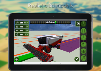
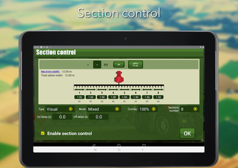
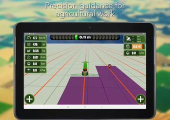
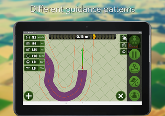
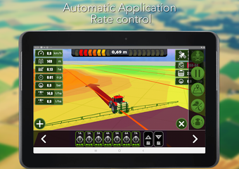
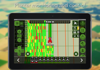
MachineryGuide GPS app (Demo) is a comprehensive solution for precision farming that supports all tractor and non-tractor related field works including spraying, fertilizing, plowing, harvesting, and sowing. This guidance application helps the farmer by showing the ideal track by gearing to straight or curve reference lines. It offers visual section control, straight and curve guidance patterns, 2D and 3D view, snapshot view on Google Maps, and dataset visualization on Google Maps.
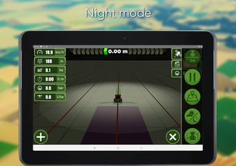
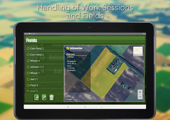
The software is compatible with any type of GPS/GNSS receiver that has Bluetooth connectivity and supports NMEA message format. It supports built-in GPS and external Bluetooth GPS connectivity and offers support for landscape and portrait mode. The app also offers field boundary handling, night mode, 3D models, and session reports, with KML and PDF export possibilities.
MachineryGuide offers GNSS solution for submeter and decimeter accuracy. These devices are dual-band GPS receivers and antennas that support GPS and GLONASS satellite signals and free SBAS corrections (EGNOS/WAAS/MSAS). It also offers RTK based solutions with centimeter level accuracy.
Please note that the demo version does not include GPS functionality.